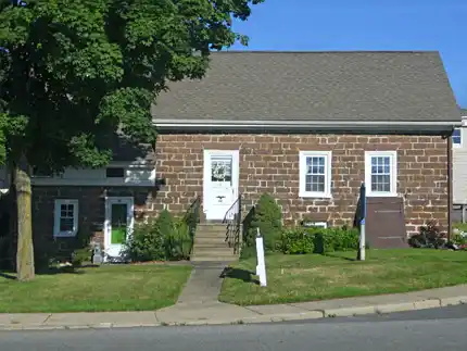
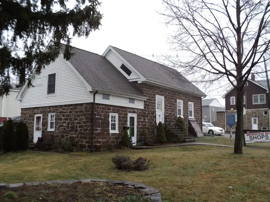
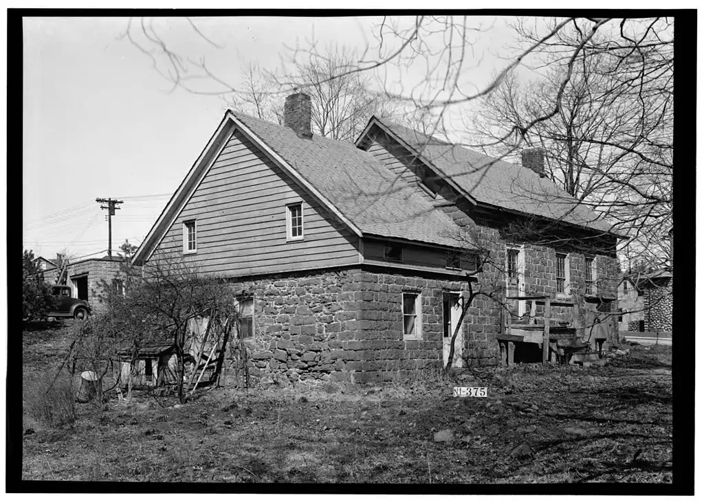
Nestled in the heart of Midland, NJ, this is a 1 ½ story two-part gable-roofed structure built of neatly cut and coursed native sandstone. The house measures 49′ 9″ across the front, the main block is 20′ deep, and the wing is 26′ deep. The basement (only under the main section) has a dirt floor, a large arched fireplace support of stone on the NE end, and heavy hewn floor beams (flooring may be original but is largely covered with linoleum). Roof rafters are trunneled, there are no ridge pole, and early roof shingle lath remains (roof is now covered with asphalt shingles). Gable ends are chap boarded. Early chimneys, as well as the fireplaces, are gone. The interior seems to have been rearranged in the first half of the 19th century and it is now a side-by-side two-family house. In the main section, trapezoidal lintels top the three fenestrations. The original front door and small sunburst light over are gone but the original sash and some glass have survived. (Two front windows are 12 over 8.) The small wing was altered by raising the roof and inserting a Greek Revival-type frieze with windows. This section may date from the mid-18th century and the main about 1775. However, since no change appears in the stonework the impression is that it was all done at the same time.
Drawings from Survey HABS NJ-375
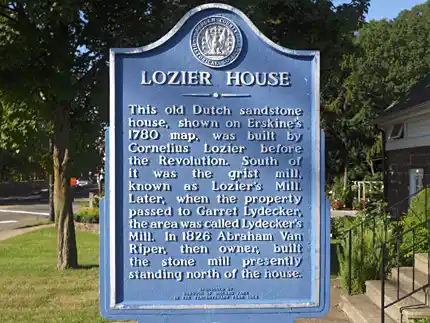
The Cornelius Lozier House was built circa 1775, and was here as the Revolutionary War activity occurred in the surrounding areas of Bergen County. The house appeared on a map of the area made in 1780 by Robert Erskine, who served as the army’s Surveyor-General and produced over 200 maps for General Washington during the Revolutionary War. Erskine lived in Ringwood, NJ, and is buried there on his property, which is now Ringwood State Park. [1]
Lozier also built a grist mill (a mill for grinding wheat into flour) nearby, which no longer stands. It was replaced in 1826 by a mill built by a later owner of the property, Abraham Van Riper, which still stands behind the house. The house and mill were added to the National Register of Historic Places on October 10, 1975. Both the house and the mill are now used as stores as part of the Brownstone Mills Shops.
Source Notes:
[1] Bergen County Historical Society historic marker• National Register of Historic Places Inventory Nomination Form for the Lozier House and Van Riper Mill.
Available as a PDF on the National Park Service website here.• A collection of Erskine’s maps can be viewed in the Archives section of the Witness to the Early American Experience website, developed by New York University Libraries in collaboration with the New-York Historical Society. The specific map where the Lozier house appears is Map #56 A. It can be hard to locate, and hard to read, but the marking for “Cornelius Lozier” appears towards the right side of the map, about 1/3 of the way down from the top of the map.
The Lozier property was initially owned by Nicholas Lozier when he moved into the Hackensack vicinity about 1697. Grandson Johannes Lozier inherited the land on the West Hackensack River, and he built the original house as well as the mill across the street. On Erskine’s map of the Ramapo Tract, Cornelius Lozier bought lot # 10 on September 1, 1774. He devised the farm to his son, John. One of the executors of the estate was Garret Lydecker. He gained possession of the area for a while. At the time of the Revolution the mill was at the south end of the road.
The next owner was Abraham Van Riper who built the present mill, which is north of the house, in 1826. The firm of Van Winkle and Park bought both mills in 1829. Munn and Whitehead were the next owners. Baldwin bought the property south of the house. The house and the old stone mill were purchased by John B. and Issac Wortendyke, and their brother Cornelius A. Wortendyke became the owner in 1876.
Cornelius Wortendyke was largely responsible for bringing the railroad into town. When he was elected president of New Jersey Western Railroad in 1867 it merged with two additional railroads and became the New Jersey Midland Railroad. The town Midland thus received its name. Cornelius Wortendyke also brought the first telephone lines into town.
This site is significant because the mill was an important area of commerce which started settlement growth in the vicinity. Evidence of this can be seen in the turbines and the 18th Century Mill apparatus that remains in the mill. Later owners fostered urbanization and trade by promoting the railroad and bettering communication with bringing the telephone into the town.
Bailey, Rosalie F., Pre-Revolutionary Dutch Houses and Families in Northern New Jersey and Southern New York, 1936
Du Bois, Katherine, “Old Mins of Bergen County” 1955
Erskine maps: G(1778), H(1779), #36 (1778), #56B (1779)
Walker, A. H. “Atlas of Bergen County”, 1876
Additional information provided by Claire Tholl, and Rosa Livingston
